C-Map EW Y227 Vaarkaart North- West Europa
Gedetailleerde beelden van de hele europese west kust (waaronder Nederland)
past in iedere visvinder/kaartplotter.
90€ Inclusief Verzenden
(nieuwprijs 240€)
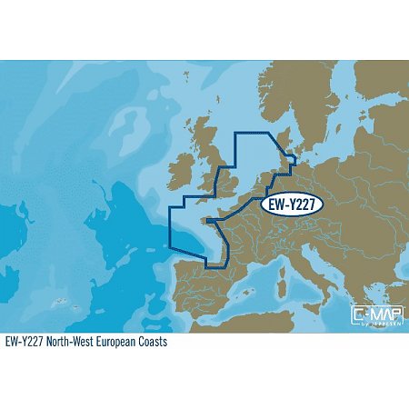
C-Map EW-Y227 Noord-West EuropaMAX-N+ charts provide accurate, up-to-date information, unique features and specialized content to enhance every boating adventure.
Easy Routing (US excluded)
Dynamic Raster Charts
High-Res Satellite Imagery
High-Res Bathy Fishing Charts/Sport Fishing Data
3D-View
Custom Shaded Depths and Aerial Photos
Detailed Marina Charts
High Resolution Bathy Data
Dynamic Tides and Currents
Telefoon; 0645308391
reden verkoop omdat ik hem dubbel heb.
past in iedere visvinder/kaartplotter.
90€ Inclusief Verzenden
(nieuwprijs 240€)
C-Map EW-Y227 Noord-West EuropaMAX-N+ charts provide accurate, up-to-date information, unique features and specialized content to enhance every boating adventure.
Easy Routing (US excluded)
Dynamic Raster Charts
High-Res Satellite Imagery
High-Res Bathy Fishing Charts/Sport Fishing Data
3D-View
Custom Shaded Depths and Aerial Photos
Detailed Marina Charts
High Resolution Bathy Data
Dynamic Tides and Currents
Telefoon; 0645308391
reden verkoop omdat ik hem dubbel heb.
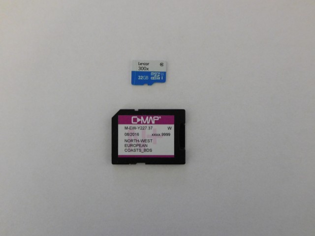
Ook alle binnenwateren zoals rivieren en meren in Nederland gedetailleerd, de kaart werkt hetzelfde als een navionics kaart. (dit ter aanvulling op mijn tekst)
Kaartje is verkocht.